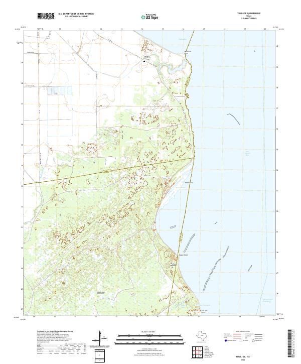
2022 Map of Tivoli SE
USGS Topo · Published 2022About this map
Austwell Cem African American stands as a significant cultural landmark near the northern marshes of this coastal landscape, situated just inland from Hynes Bay. The terrain is defined by the convergence of several county lines where Refugio, Calhoun, and Aransas counties meet amidst a complex network of wetlands and tidal flats. Dominating the southern portion of the sheet is the Black Jack Peninsula, which separates the interior marshes from the open waters of San Antonio Bay.
Find a feature on this map
29 named features on this map. Tap any name to fly to it.
Don’t see what you’re looking for? This feature index may not catch every label — zoom into the map to look around manually.
Map Details
Editions of this 2022 Tivoli SE Map
This is the sole edition of this map. No revisions or reprints were ever made.
Other maps of this area

1952 · Mosquito Point
USGS Topo · 1:24,000

1952 · St. Charles Bay
USGS Topo · 1:24,000

1952 · Tivoli
USGS Topo · 1:24,000

1952 · Mesquite Bay
USGS Topo · 1:24,000

1952 · Tivoli SE
USGS Topo · 1:24,000

1952 · Panther Point
USGS Topo · 1:24,000

1952 · Austwell
USGS Topo · 1:24,000

1952 · Seadrift
USGS Topo · 1:24,000

1952 · Tivoli SW
USGS Topo · 1:24,000

1953 · Beeville
USGS Topo · 1:250,000