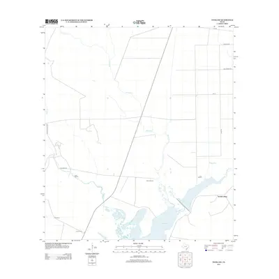
2013 Map of Tivoli SW
USGS Topo · Published 2013About this map
Spanish Village sits near the eastern edge of this coastal landscape, where the waters of Burgentine Lake and Burgentine Cr meet the northern reaches of St Charles Bay. The area is defined by a sparse but organized network of ranch roads and cattle-related infrastructure, characteristic of the Texas Gulf Coast's agricultural heritage. Numerous named landmarks such as Hawes Windmill, Willow Windmill, and Lucky Windmill serve as essential water sources across the flat, low-lying terrain. Several watercourses, including Artesian Cr, Willow Cr, and Salt Cr, snake through the grid of property lines and rural routes like FM-774 and Kelso RD. This map documents a working landscape where geography is measured as much by drainage and water access as by the road network.
Find a feature on this map
19 named features on this map. Tap any name to fly to it.
Don’t see what you’re looking for? This feature index may not catch every label — zoom into the map to look around manually.
Map Details
Editions of this 2013 Tivoli SW Map
This is the sole edition of this map. No revisions or reprints were ever made.
Other maps of this area

1952 · St. Charles Bay
USGS Topo · 1:24,000

1952 · Tivoli
USGS Topo · 1:24,000

1952 · Mesquite Bay
USGS Topo · 1:24,000

1952 · Tivoli SE
USGS Topo · 1:24,000

1952 · Austwell
USGS Topo · 1:24,000

1952 · Tivoli SW
USGS Topo · 1:24,000

1953 · Beeville
USGS Topo · 1:250,000

1954 · Rockport
USGS Topo · 1:62,500

1954 · Vidaurri
USGS Topo · 1:62,500

1956 · Beeville
USGS Topo · 1:250,000