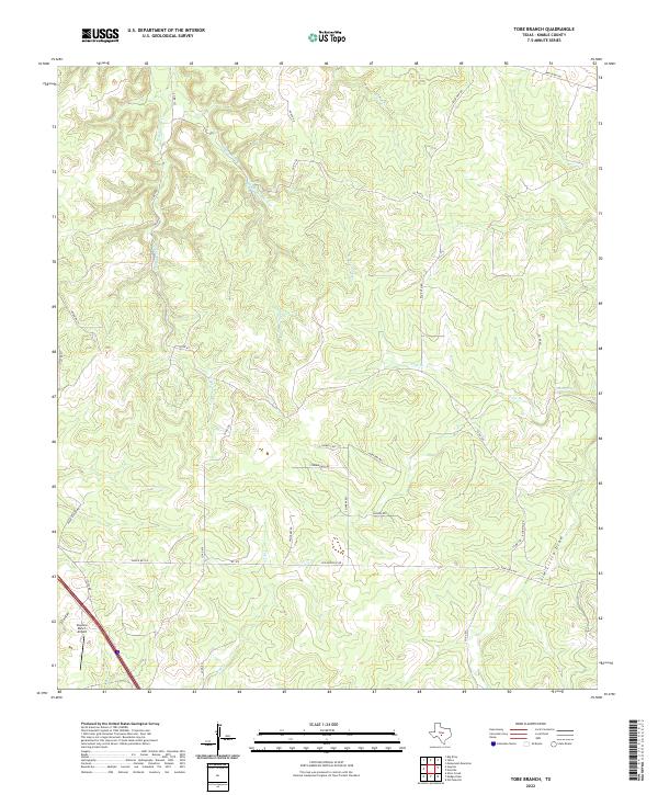
2022 Map of Tobe Branch
USGS Topo · Published 2022About this map
The Skyview Ranch Airport serves as a small aviation anchor in this corner of the Hill Country, where the landscape is defined by the complex drainage of the Sycamore Cr system. Multiple branches, including W Sycamore Cr, E Sycamore Cr, and Middle Sycamore Cr, carve through the terrain, illustrating the persistent water-carved geography of Kimble County. Further east, the Tobe Br and its source at Tobe Spring highlight the critical role of reliable water sources in this ranching region.
Find a feature on this map
35 named features on this map. Tap any name to fly to it.
Don’t see what you’re looking for? This feature index may not catch every label — zoom into the map to look around manually.
Map Details
Editions of this 2022 Tobe Branch Map
This is the sole edition of this map. No revisions or reprints were ever made.
Other maps of this area

1887 · Mason
USGS Topo · 1:125,000

1894 · Mason
USGS Topo · 1:125,000

1894 · Kerrville
USGS Topo · 1:125,000

1954 · Llano
USGS Topo · 1:250,000

1955 · Llano
USGS Topo · 1:250,000

1956 · Llano
USGS Topo · 1:250,000

1968 · Monument Mountain
USGS Topo · 1:24,000

1968 · Yates
USGS Topo · 1:24,000
1970 · Big Draw
USGS Topo · 1:24,000
1974 · Noxville
USGS Topo · 1:24,000