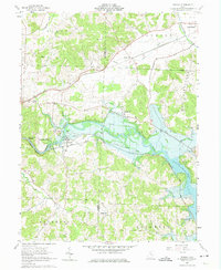
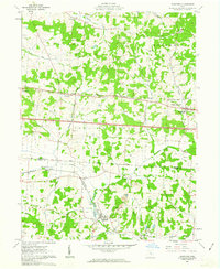
1962 Map of Toboso
USGS Topo · Published 1974About this map
The Licking River carves a dramatic path through the Muskingum and Licking County line, defining the landscape of this 1960s-era survey. The valley features prominent geological landmarks such as Black Hand Narrows and the Licking Gorge, which are flanked by the Pennsylvania Railroad and the Baltimore and Ohio Railroad. This period marks a significant transition for the local hydrology with the presence of Dillon Lake, where areas are marked as subject to controlled inundation.
Find a feature on this map
36 named features on this map. Tap any name to fly to it.
Don’t see what you’re looking for? This feature index may not catch every label — zoom into the map to look around manually.
Map Details
Editions of this 1962 Toboso Map
4 editions found
Other maps of this area

1909 · Newark
USGS Topo · 1:62,500

1909 · Thornville
USGS Topo · 1:62,500

1910 · Frazeysburg
USGS Topo · 1:62,500

1910 · Zanesville
USGS Topo · 1:62,500

1947 · Columbus
USGS Topo · 1:250,000

1950 · Marion
USGS Topo · 1:250,000

1961 · Columbus
USGS Topo · 1:250,000

1961 · Hanover
USGS Topo · 1:24,000

1961 · Zanesville West
USGS Topo · 1:24,000
1961 · Glenford
USGS Topo · 1:24,000