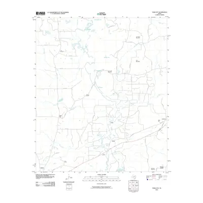
2010 Map of Todd City
USGS Topo · Published 2010About this map
Todd City and the surrounding rural landscape of Cherokee County are defined by a mix of agricultural traditions and energy development. The presence of the Todd City Oil Field and Neches Oil Field points to the industrial importance of this region, which is balanced by a network of long-established community landmarks. Local heritage is preserved at sites like the Miller Cemetery, Earls Chapel, and Pierces Chapel, which serve as anchors for families tracing their roots in the area. The terrain is notably varied for the region, marked by prominent elevations such as Jim Beard Mountain, Cary Lake Mountain, and Tater Hill. Water plays a central role in the local geography, with Hurricane Lake and Alligator Lake in the north, while Brushy Creek and Walnut Creek drain the central and southern reaches near Prices and Ironton.
Find a feature on this map
54 named features on this map. Tap any name to fly to it.
Don’t see what you’re looking for? This feature index may not catch every label — zoom into the map to look around manually.
Map Details
Editions of this 2010 Todd City Map
This is the sole edition of this map. No revisions or reprints were ever made.
Other maps of this area

1946 · Bullard
USGS Topo · 1:62,500

1948 · Bullard
USGS Topo · 1:62,500

1949 · Palestine
USGS Topo · 1:62,500

1949 · Frankston
USGS Topo · 1:62,500

1950 · Palestine
USGS Topo · 1:62,500

1950 · Frankston
USGS Topo · 1:62,500

1951 · Jacksonville
USGS Topo · 1:62,500

1953 · Palestine
USGS Topo · 1:250,000

1956 · Tyler
USGS Topo · 1:250,000

1957 · Palestine
USGS Topo · 1:250,000