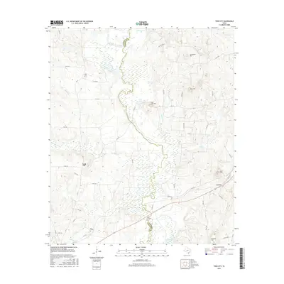
2016 Map of Todd City
USGS Topo · Published 2016About this map
The Neches River forms a winding, complex boundary between Anderson and Cherokee counties, anchoring a landscape defined by its river-bottom wetlands and upland ridges. Low-lying areas along the river are dotted with numerous named oxbows and reservoirs, including Alligator Lake, Cary Lake, and Hurricane Lake. These wetlands contrast with the prominent rises to the east, such as Jim Beard Mtn and Gray Mtn, which provide a distinct topographic variety to the region.
Find a feature on this map
55 named features on this map. Tap any name to fly to it.
Don’t see what you’re looking for? This feature index may not catch every label — zoom into the map to look around manually.
Map Details
Editions of this 2016 Todd City Map
This is the sole edition of this map. No revisions or reprints were ever made.
Other maps of this area
1946 · Bullard
USGS Topo · 1:62,500
1948 · Bullard
USGS Topo · 1:62,500
1949 · Palestine
USGS Topo · 1:62,500
1949 · Frankston
USGS Topo · 1:62,500
1950 · Palestine
USGS Topo · 1:62,500
1950 · Frankston
USGS Topo · 1:62,500
1951 · Jacksonville
USGS Topo · 1:62,500

1953 · Palestine
USGS Topo · 1:250,000

1956 · Tyler
USGS Topo · 1:250,000

1957 · Palestine
USGS Topo · 1:250,000