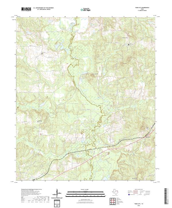
2022 Map of Todd City
USGS Topo · Published 2022About this map
The Neches River carves a winding path along the boundary of Anderson and Cherokee counties, defining the character of this East Texas landscape. Historically established as a farming and timber area, the region features a network of rural roads connecting small settlements and family landmarks. In the east, elevations rise toward local peaks such as Gray Mtn and Jim Beard Mtn, while the bottomlands are marked by numerous water bodies including Alligator Lake and Cary Lake. The map details the small community centers of Todd City and Ironton, offering researchers clear locations for family history sites like Miller Cem and Corine Cem. This modern topographic study illuminates the traditional drainage patterns of tributaries like Kickapoo Br and Boggy Cr, showing how the terrain transitions from river-fed wetlands to the high ground of Tater Hill.
Find a feature on this map
55 named features on this map. Tap any name to fly to it.
Don’t see what you’re looking for? This feature index may not catch every label — zoom into the map to look around manually.
Map Details
Editions of this 2022 Todd City Map
This is the sole edition of this map. No revisions or reprints were ever made.
Other maps of this area

1946 · Bullard
USGS Topo · 1:62,500

1948 · Bullard
USGS Topo · 1:62,500

1949 · Palestine
USGS Topo · 1:62,500

1949 · Frankston
USGS Topo · 1:62,500

1950 · Palestine
USGS Topo · 1:62,500

1950 · Frankston
USGS Topo · 1:62,500

1951 · Jacksonville
USGS Topo · 1:62,500

1953 · Palestine
USGS Topo · 1:250,000

1956 · Tyler
USGS Topo · 1:250,000

1957 · Palestine
USGS Topo · 1:250,000