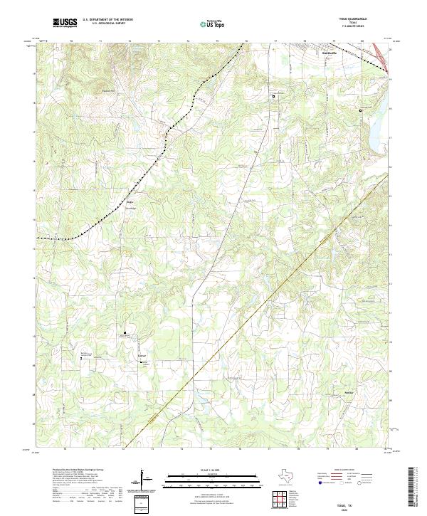
2022 Map of Togo
USGS Topo · Published 2022About this map
The Bastrop and Fayette County line cuts diagonally across this central Texas landscape, where the Colorado River valley gives way to a network of creeks and small farming settlements. In the southern half, the community of Kovar serves as a cultural anchor, evidenced by the clustered presence of the SPJST Kovar Brethren Cem, Kovar Catholic Cem, and nearby Bartons Creek Catholic Cem. These sites speak to the specific ethnic and religious heritage of the area's early settlers.
Find a feature on this map
50 named features on this map. Tap any name to fly to it.
Don’t see what you’re looking for? This feature index may not catch every label — zoom into the map to look around manually.
Map Details
Editions of this 2022 Togo Map
This is the sole edition of this map. No revisions or reprints were ever made.
Other maps of this area

1885 · Bastrop
USGS Topo · 1:125,000

1893 · Bastrop
USGS Topo · 1:125,000

1901 · Flatonia
USGS Topo · 1:125,000

1904 · Bastrop
USGS Topo · 1:125,000

1948 · Smithville
USGS Topo · 1:62,500

1948 · Bastrop
USGS Topo · 1:62,500

1950 · Bastrop
USGS Topo · 1:62,500

1950 · Smithville
USGS Topo · 1:62,500

1953 · Seguin
USGS Topo · 1:250,000

1954 · Austin
USGS Topo · 1:250,000