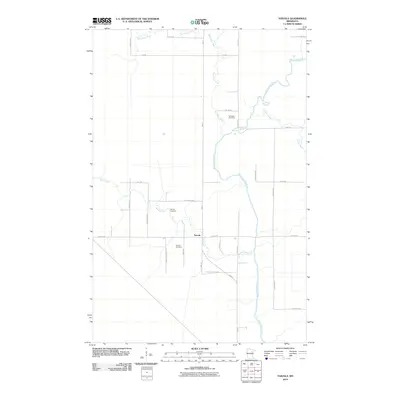
2010 Map of Toivola
USGS Topo · Published 2010About this map
Toivola serves as the central hub of this northern Minnesota quadrangle, where a grid of local roads meets the winding course of the Saint Louis River. The landscape is defined by its complex hydrology, with the West Swan River and East Swan River converging in the north before joining the main river channel. This pattern of drainage suggests a low-lying, water-dominant environment characteristic of Saint Louis County’s river valleys. For genealogists and local historians, the presence of Sarikoski Cemetery and Toivola Cemetery provides specific points of interest for family research. The road network, including family-named routes like John Lahti Rd, Saralampi Rd, and Maki Rd, reflects the settlement history and rural development of the area in the early 21st century.
Find a feature on this map
30 named features on this map. Tap any name to fly to it.
Don’t see what you’re looking for? This feature index may not catch every label — zoom into the map to look around manually.
Map Details
Editions of this 2010 Toivola Map
This is the sole edition of this map. No revisions or reprints were ever made.
Other maps of this area

1951 · Casco
USGS Topo · 1:24,000

1952 · Riley
USGS Topo · 1:24,000

1952 · Little Swan
USGS Topo · 1:24,000

1954 · Hibbing
USGS Topo · 1:250,000

1957 · Hibbing
USGS Topo · 1:250,000

1958 · Hibbing
USGS Topo · 1:250,000

1963 · Elmer
USGS Topo · 1:24,000

1963 · Toivola SW
USGS Topo · 1:24,000

1963 · Upstead Lake
USGS Topo · 1:24,000

1963 · Meadowlands NW
USGS Topo · 1:24,000