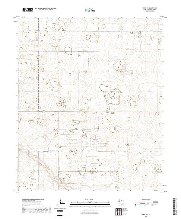
2022 Map of Tokio NW
USGS Topo · Published 2022About this map
Sulphur Springs Draw meanders through the southern portion of this West Texas landscape, providing a rare natural drainage feature in an area dominated by agricultural and ranching gridwork. This modern survey of Yoakum County reveals a highly organized network of county roads and family-named routes such as Poindexter Rd, Ownby Loop Rd, and S Ownby Loop Rd. The alignment of these thoroughfares, including the northern and eastern stretches of Morris Lowe Rd N and Morris Lowe Rd E, reflects the enduring parceling of the High Plains for regional land use. The presence of 4-Mile Lateral Rd suggests the Importance of water management and irrigation in this semi-arid environment, while the proximity of Ranch Rd 435 connects the localized farm-to-market traffic to the broader Texas highway system.
Find a feature on this map
19 named features on this map. Tap any name to fly to it.
Don’t see what you’re looking for? This feature index may not catch every label — zoom into the map to look around manually.
Map Details
Editions of this 2022 Tokio NW Map
This is the sole edition of this map. No revisions or reprints were ever made.
Other maps of this area

1954 · Brownfield
USGS Topo · 1:250,000

1958 · Brownfield
USGS Topo · 1:250,000

1962 · Brownfield
USGS Topo · 1:250,000

1969 · Plains 1 SE
USGS Topo · 1:24,000

1970 · Plains 1 SW
USGS Topo · 1:24,000

1970 · Tokio
USGS Topo · 1:24,000

1970 · Tokio NW
USGS Topo · 1:24,000
1970 · Tokio SE
USGS Topo · 1:24,000

1970 · Pleasant Hill
USGS Topo · 1:24,000
1971 · Plains SE
USGS Topo · 1:24,000