
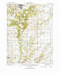
1933 Map of Toledo
USGS Topo · Published 1958About this map
The Embarrass River carves a deep, winding valley through this part of east-central Illinois, creating a landscape defined by sharp bluffs and forested breaks that contrast with the surrounding level prairie. This survey, compiled from early aerial photography by the U.S. Army Air Corps, highlights the cultural significance of Lincoln Log Cabin State Park and the rugged recreational areas of The Rocks Park. The river was a central artery for movement, evidenced by numerous named crossings such as Halls Ford, Walker Ford, and Hanley Ford, as well as the landmark Ryan Bridge.
Find a feature on this map
109 named features on this map. Tap any name to fly to it.
Don’t see what you’re looking for? This feature index may not catch every label — zoom into the map to look around manually.
Map Details
Editions of this 1933 Toledo Map
2 editions found
Other maps of this area

1934 · Mattoon
USGS Topo · 1:62,500

1935 · Arcola
USGS Topo · 1:48,000

1936 · Oakland
USGS Topo · 1:48,000

1936 · Casey
USGS Topo · 1:48,000

1937 · Mattoon
USGS Topo · 1:62,500

1938 · Toledo
USGS Topo · 1:62,500

1940 · Arcola
USGS Topo · 1:62,500

1940 · Greenup
USGS Topo · 1:62,500

1942 · Oakland
USGS Topo · 1:62,500

1942 · Casey
USGS Topo · 1:62,500