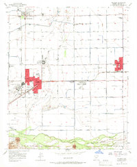
1957 Map of Tolleson
USGS Topo · Published 1966About this map
The agricultural landscape of the Buckeye Valley is defined by the convergence of the Agua Fria River and the Gila River in this mid-century survey. Irrigation and rail transport center around the growing communities of Avondale, Goodyear, and Tolleson, where the Southern Pacific railroad facilitates the movement of crops. A distinct military and recreational presence is evident through the Litchfield Park Naval Air Facility and the nearby Wigwam Country Club.
Find a feature on this map
37 named features on this map. Tap any name to fly to it.
Don’t see what you’re looking for? This feature index may not catch every label — zoom into the map to look around manually.
Map Details
Editions of this 1957 Tolleson Map
5 editions found

Other maps of this area

1912 · Phoenix
USGS Topo · 1:62,500

1914 · Phoenix
USGS Topo · 1:62,500

1946 · Avondale
USGS Topo · 1:62,500

1948 · Cashion
USGS Topo · 1:62,500

1952 · Laveen
USGS Topo · 1:24,000

1952 · Fowler
USGS Topo · 1:24,000

1952 · Phoenix
USGS Topo · 1:62,500

1954 · Phoenix
USGS Topo · 1:250,000

1957 · Phoenix
USGS Topo · 1:250,000

1957 · Perryville
USGS Topo · 1:24,000