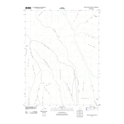
2011 Map of Tom Patterson Canyon
USGS Topo · Published 2011About this map
Mc Cook Ridge dominates this high plateau landscape within the Book Cliffs Natural Area, where a series of long ridges and deep drainages define the geography of eastern Utah. The map traces the winding course of Mc Cook Ridge Rd as it follows the high ground between Tom Patterson Canyon and Rat Hole Canyon. This area is characterized by dramatic elevation changes, with prominent overlooks like Tom Patterson Point and Black Horse Point providing vantage points over the surrounding canyon systems. Grounded in the arid environment, Sweet Water Spring and the drainage of Bitter Creek represent vital water sources in an otherwise dry terrain. Names like Moccasin Trail Canyon, Chipeta Canyon, and Moonshine Canyon reflect the cultural and historical layers of this remote section of Uintah County.
Find a feature on this map
30 named features on this map. Tap any name to fly to it.
Don’t see what you’re looking for? This feature index may not catch every label — zoom into the map to look around manually.
Map Details
Editions of this 2011 Tom Patterson Canyon Map
This is the sole edition of this map. No revisions or reprints were ever made.
Other maps of this area

1885 · East Tavaputs
USGS Topo · 1:250,000

1956 · Grand Junction
USGS Topo · 1:250,000

1959 · Grand Junction
USGS Topo · 1:250,000

1960 · Grand Junction
USGS Topo · 1:250,000

1962 · Grand Junction
USGS Topo · 1:250,000

1964 · Grand Junction
USGS Topo · 1:250,000

1965 · Grand Junction
USGS Topo · 1:250,000

1966 · Seep Canyon
USGS Topo · 1:24,000

1966 · Tom Patterson Canyon
USGS Topo · 1:24,000
1966 · Rat Hole Ridge
USGS Topo · 1:24,000