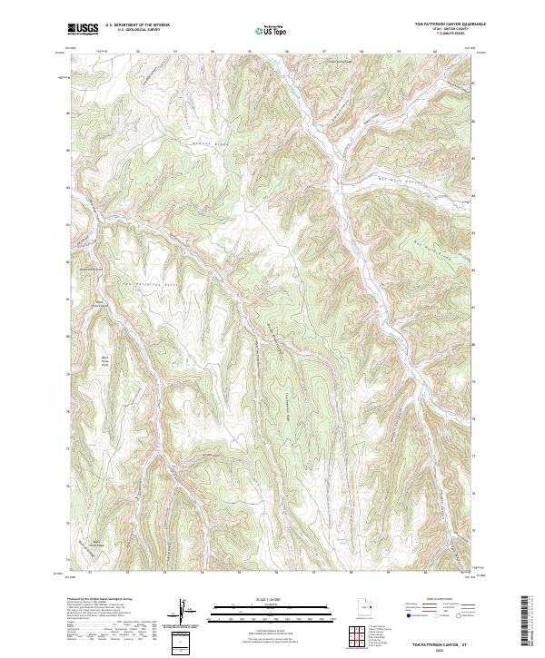
2023 Map of Tom Patterson Canyon
USGS Topo · Published 2023About this map
Tom Patterson Canyon serves as the central drainage for this section of Uintah County, where a complex network of ridges and canyons defines the local geography. The landscape is characterized by prominent high points such as Black Horse Point and Tom Patterson Point, which overlook the deep incisions of Gorge Canyon and South Canyon. Along the drainages, reliable water sources are noted at Black Horse Spring and Tom Patterson Spring, which historically supported movement through this high desert environment.
Find a feature on this map
39 named features on this map. Tap any name to fly to it.
Don’t see what you’re looking for? This feature index may not catch every label — zoom into the map to look around manually.
Map Details
Editions of this 2023 Tom Patterson Canyon Map
This is the sole edition of this map. No revisions or reprints were ever made.
Other maps of this area

1885 · East Tavaputs
USGS Topo · 1:250,000

1956 · Grand Junction
USGS Topo · 1:250,000

1959 · Grand Junction
USGS Topo · 1:250,000

1960 · Grand Junction
USGS Topo · 1:250,000

1962 · Grand Junction
USGS Topo · 1:250,000

1964 · Grand Junction
USGS Topo · 1:250,000

1965 · Grand Junction
USGS Topo · 1:250,000

1966 · Seep Canyon
USGS Topo · 1:24,000

1966 · Tom Patterson Canyon
USGS Topo · 1:24,000
1966 · Rat Hole Ridge
USGS Topo · 1:24,000