
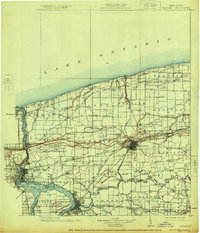
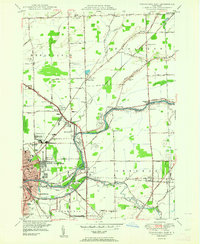
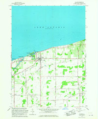
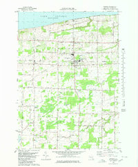
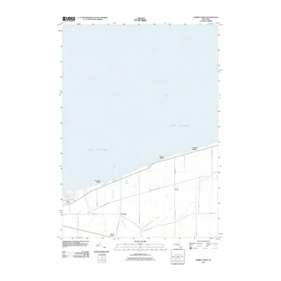
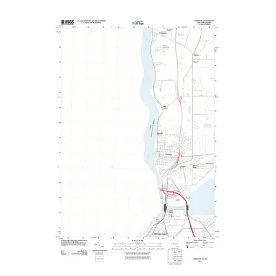
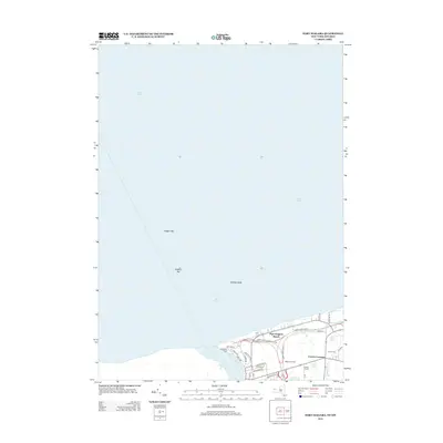
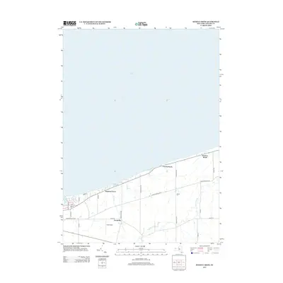
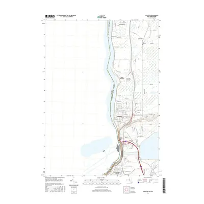
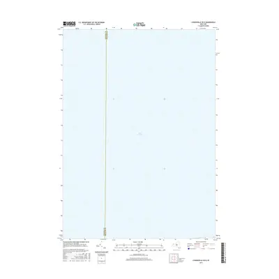
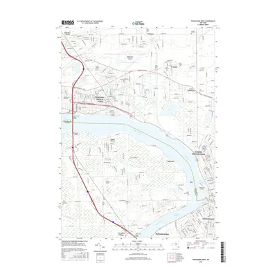
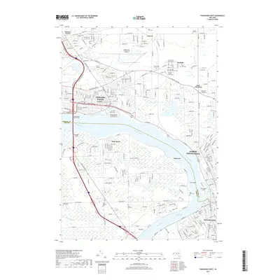
1950 Map of Tonawanda East
USGS Topo · Published 1950About this map
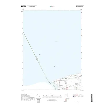
Tonawanda Creek and the Erie Canal dominate this 1950 landscape, serving as the industrial and geographical dividing line between Niagara and Erie counties. The transition from the urban centers of North Tonawanda and Tonawanda to the rural townships of Wheatfield and Pendleton is clearly visible, marked by a dense network of transport infrastructure. Multiple rail lines, including the New York Central Railroad and the International Railway, converge near the waterway, highlighting the area's role as a major regional transit hub.
Find a feature on this map
65 named features on this map. Tap any name to fly to it.
Don’t see what you’re looking for? This feature index may not catch every label — zoom into the map to look around manually.
Map Details
Editions of this 1950 Tonawanda East Map
2 editions found
Historical Maps of Amherst Through Time
85 maps found
1894 Wilson
Niagara County, NY
1899 Niagara
Niagara County, NY
1900 Wilson
Niagara County, NY

1948 Tonawanda West
Niagara County, NY

1948 Wilson
Niagara County, NY

1949 Barker
Niagara County, NY

1949 Cambria
Niagara County, NY

1949 Sixmile Creek
Niagara County, NY
1949 Wilson
Niagara County, NY

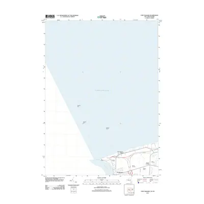
1950 Ft Niagara
Niagara County, NY

1950 Lewiston
Niagara County, NY

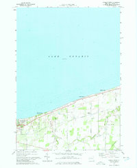
1950 Newfane
Niagara County, NY
1950 Tonawanda East
Niagara County, NY

1950 Tonawanda West
Niagara County, NY

1952 Toronto
Niagara County, NY

1954 Tonawanda West
Niagara County, NY

1962 Toronto
Niagara County, NY
1965 Barker
Niagara County, NY

1965 Cambria
Niagara County, NY

1965 Ft Niagara
Niagara County, NY

1965 Lewiston
Niagara County, NY
1965 Newfane
Niagara County, NY
1965 Sixmile Creek
Niagara County, NY

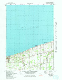
1965 Tonawanda East
Niagara County, NY

1965 Tonawanda West
Niagara County, NY

1965 Toronto
Niagara County, NY
1965 Wilson
Niagara County, NY
1973 Sixmile Creek
Niagara County, NY
1974 Sixmile Creek
Niagara County, NY
1978 Newfane
Niagara County, NY
1980 Barker
Niagara County, NY

1980 Cambria
Niagara County, NY

1980 Ft Niagara
Niagara County, NY

1980 Lewiston
Niagara County, NY

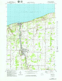
1980 Tonawanda East
Niagara County, NY

1980 Tonawanda West
Niagara County, NY
2010 Barker
Niagara County, NY
2010 Cambria
Niagara County, NY
2010 Newfane
Niagara County, NY
2010 Sixmile Creek
Niagara County, NY
2010 Tonawanda East
Niagara County, NY
2010 Tonawanda West
Niagara County, NY
2010 Wilson
Niagara County, NY
2011 Lewiston
Niagara County, NY
2012 Fort Niagara
Niagara County, NY
2013 Barker
Niagara County, NY
2013 Cambria
Niagara County, NY
2013 Fort Niagara
Niagara County, NY
2013 Lewiston
Niagara County, NY
2013 Lyndonville OE N
Niagara County, NY
2013 Newfane
Niagara County, NY
2013 Sixmile Creek
Niagara County, NY
2013 Tonawanda East
Niagara County, NY
2013 Tonawanda West
Niagara County, NY
2013 Wilson
Niagara County, NY
2016 Barker
Niagara County, NY
2016 Cambria
Niagara County, NY
2016 Fort Niagara
Niagara County, NY
2016 Lewiston
Niagara County, NY
2016 Lyndonville OE N
Niagara County, NY
2016 Newfane
Niagara County, NY
2016 Sixmile Creek
Niagara County, NY
2016 Tonawanda East
Niagara County, NY
2016 Tonawanda West
Niagara County, NY
2016 Wilson
Niagara County, NY
2019 Barker
Niagara County, NY
2019 Cambria
Niagara County, NY
2019 Fort Niagara
Niagara County, NY
2019 Lewiston
Niagara County, NY
2019 Lyndonville OE N
Niagara County, NY
2019 Newfane
Niagara County, NY
2019 Sixmile Creek
Niagara County, NY
2019 Tonawanda East
Niagara County, NY
2019 Tonawanda West
Niagara County, NY
2019 Wilson
Niagara County, NY

2023 Barker
Niagara County, NY

2023 Cambria
Niagara County, NY

2023 Fort Niagara
Niagara County, NY

2023 Lewiston
Niagara County, NY
2023 Lyndonville OE N
Niagara County, NY

2023 Newfane
Niagara County, NY

2023 Sixmile Creek
Niagara County, NY

2023 Tonawanda East
Niagara County, NY

2023 Tonawanda West
Niagara County, NY

2023 Wilson
Niagara County, NY