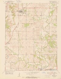
1951 Map of Tonganoxie
USGS Topo · Published 1951About this map
Stranger Creek and its many tributaries, including Ninemile Creek and Sarcoxie Creek, define the landscape of southern Leavenworth County at the start of the 1950s. This survey illustrates a dense network of rural infrastructure, where nearly every section contains a local schoolhouse such as Honey Valley Sch, Hawk Hollow Sch, or Pickens Sch. The primary settlements of Tonganoxie and Linwood serve as anchors for the surrounding farmsteads, with the Union Pacific railroad skirting the southern edge of the quadrangle near the Johnson County line. Family and community heritage is deeply rooted here, evidenced by numerous small burial grounds like Maple Grove Cem, Hemple Cem, and Chance Cem scattered throughout the townships. The transition from agricultural land to early industrial utility is visible in features like the Quarry and the Sewage Disposal plant near the Tonganoxie city boundary.
Find a feature on this map
33 named features on this map. Tap any name to fly to it.
Don’t see what you’re looking for? This feature index may not catch every label — zoom into the map to look around manually.
Map Details
Editions of this 1951 Tonganoxie Map
4 editions found
Other maps of this area

1885 · Lawrence
USGS Topo · 1:125,000

1886 · Oskaloosa
USGS Topo · 1:125,000

1887 · Olathe
USGS Topo · 1:125,000

1888 · Oskaloosa
USGS Topo · 1:125,000

1889 · Lawrence
USGS Topo · 1:125,000

1890 · Kansas City
USGS Topo · 1:125,000

1893 · Olathe
USGS Topo · 1:125,000

1894 · Kansas City
USGS Topo · 1:125,000

1894 · Oskaloosa
USGS Topo · 1:125,000

1934 · Bonner Springs
USGS Topo · 1:48,000