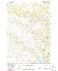
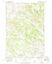
1967 Map of Tongue River Dam
USGS Topo · Published 1985About this map
Tongue River Reservoir dominates the southeastern corner of this Big Horn and Rosebud County landscape, held in check by the Tongue River Dam. Surveyed in the late 1960s, the terrain is defined by a dense network of drainages that feed the Tongue River, including Leaf Rock Creek and the meandering Post Creek. The topography reveals the complex erosional patterns of the Montana plains, punctuated by features like Barber Draw and various forks of North Fork Fourmile Creek. Evidence of resource exploration and hydrological management is present through the marking of a Drill Hole, a Gravel Pit, and a Gaging Sta near the reservoir. The map also clearly delineates the political boundary where Big Horn Co Rosebud Co meet, following the rugged high ground between watersheds.
Find a feature on this map
18 named features on this map. Tap any name to fly to it.
Don’t see what you’re looking for? This feature index may not catch every label — zoom into the map to look around manually.
Map Details
Editions of this 1967 Tongue River Dam Map
2 editions found
Other maps of this area

1954 · Hardin
USGS Topo · 1:250,000

1957 · Hardin
USGS Topo · 1:250,000

1958 · Hardin
USGS Topo · 1:250,000

1967 · Holmes Ranch
USGS Topo · 1:24,000

1967 · Tongue River Dam
USGS Topo · 1:24,000

1967 · Kirby
USGS Topo · 1:24,000
1967 · Spring Gulch
USGS Topo · 1:24,000
1967 · Pearl School
USGS Topo · 1:24,000
1967 · Taintor Desert
USGS Topo · 1:24,000
1967 · Birney SW
USGS Topo · 1:24,000