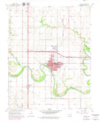
1968 Map of Tonkawa
USGS Topo · Published 1979About this map
The meandering Salt Fork Arkansas River dominates this mid-century portrait of Tonkawa, Oklahoma, where the river's deep loops define the southern edge of the city. As a regional hub for education and commerce, the community is anchored by the campus of Northern Oklahoma Jr College, surrounded by local institutions like Lincoln School and Washington School. The town's layout reflects a period of established growth, with Blen Park and Ray See Park providing green space amidst the grid.
Find a feature on this map
32 named features on this map. Tap any name to fly to it.
Don’t see what you’re looking for? This feature index may not catch every label — zoom into the map to look around manually.
Map Details
Editions of this 1968 Tonkawa Map
2 editions found
Other maps of this area

1955 · Enid
USGS Topo · 1:250,000

1958 · Enid
USGS Topo · 1:250,000

1968 · Billings
USGS Topo · 1:24,000

1968 · Tonkawa SE
USGS Topo · 1:24,000

1968 · Marland
USGS Topo · 1:24,000

1968 · Ponca City NW
USGS Topo · 1:24,000

1968 · Eddy
USGS Topo · 1:24,000

1968 · Nardin
USGS Topo · 1:24,000

1968 · Tonkawa
USGS Topo · 1:24,000

1968 · Blackwell
USGS Topo · 1:24,000