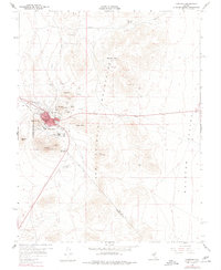
1960 Map of Tonopah
USGS Topo · Published 1977About this map
Tonopah anchors this desert landscape, its street grid and industrial footprint shaped by the surrounding San Antonio Mountains. The 1960 survey illustrates the high density of mining claims encircling the town, where names like Mizpah, Belmont, and Desert Queen cluster around the slopes of Mt Oddie and Ararat Mtn. This concentration of infrastructure reveals the intensity of mineral exploration that defined the region, with specialized features like the Tonopah Beacon and a Radio Relay Sta perched on Booker Mtn. Beyond the town, the terrain transitions into the broad Ralston Valley, punctuated by landmarks such as Henderson Park and a large Military Reservation. Local water sources, critical in this arid environment, are specifically noted at Ice Plant Spring and Slime Wash along the western edge of the quadrangle.
Find a feature on this map
39 named features on this map. Tap any name to fly to it.
Don’t see what you’re looking for? This feature index may not catch every label — zoom into the map to look around manually.
Map Details
Editions of this 1960 Tonopah Map
4 editions found
Other maps of this area

1907 · Tonopah
USGS Topo · 1:250,000

1908 · Lida
USGS Topo · 1:250,000

1908 · Tonopah
USGS Topo · 1:250,000

1913 · Lida
USGS Topo · 1:250,000

1945 · Goldfield
USGS Topo · 1:125,000

1952 · Mud Lake
USGS Topo · 1:62,500

1954 · Goldfield
USGS Topo · 1:250,000

1955 · Goldfield
USGS Topo · 1:250,000

1956 · Tonopah
USGS Topo · 1:250,000

1958 · Goldfield
USGS Topo · 1:250,000