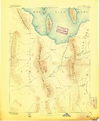
1885 Map of Tooele Valley
USGS Topo · Published 1905About this map
Tooele and its neighboring valleys appear here at a pivotal moment for territorial development, showing the expansion of mining and agriculture before the modern infrastructure of the twentieth century. The map highlights early industrial corridors such as the Utah and Nevada R. R., which links the southern shores of the Great Salt Lake to the foothills of the Oquirrh Mountains. Mining activity is evident in the dense settlement patterns around Ophir, Lewiston, and Bingham, locations that would soon become world-renowned for their mineral output.
Find a feature on this map
36 named features on this map. Tap any name to fly to it.
Don’t see what you’re looking for? This feature index may not catch every label — zoom into the map to look around manually.
Map Details
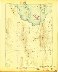
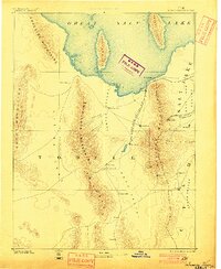
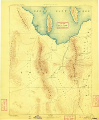
Editions of this 1885 Tooele Valley Map
6 editions found

Other maps of this area

1885 · Salt Lake
USGS Topo · 1:250,000

1885 · Manti
USGS Topo · 1:250,000

1885 · Sevier Desert
USGS Topo · 1:250,000

1885 · Tooele Valley
USGS Topo · 1:250,000

1895 · Manti
USGS Topo · 1:250,000

1908 · Fish Springs
USGS Topo · 1:250,000

1910 · Fish Springs
USGS Topo · 1:250,000

1915 · Fairfield
USGS Topo · 1:62,500

1917 · Fairfield
USGS Topo · 1:62,500

1918 · Stockton
USGS Topo · 1:62,500