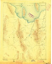
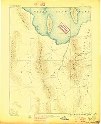
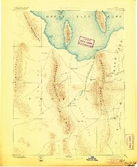
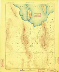
1885 Map of Tooele Valley
USGS Topo · Published 1900About this map
The south shore of the Great Salt Lake dominates the upper half of this reconnaissance survey, revealing the early layout of mining districts and Mormon settlements in the late nineteenth century. In the shadow of the Oquirrh Mountains, mining camps like Ophir and Lewiston are established alongside Bingham, while agricultural hubs such as Grantsville and Tooele anchor the valleys. The path of the Utah and Nevada R. R. follows the base of the mountains to Lake Point, providing a critical link for the region's burgeoning extraction economy.
Find a feature on this map
36 named features on this map. Tap any name to fly to it.
Don’t see what you’re looking for? This feature index may not catch every label — zoom into the map to look around manually.
Map Details
Editions of this 1885 Tooele Valley Map
6 editions found

Other maps of this area

1885 · Salt Lake
USGS Topo · 1:250,000

1885 · Manti
USGS Topo · 1:250,000

1885 · Sevier Desert
USGS Topo · 1:250,000

1885 · Tooele Valley
USGS Topo · 1:250,000

1895 · Manti
USGS Topo · 1:250,000

1908 · Fish Springs
USGS Topo · 1:250,000

1910 · Fish Springs
USGS Topo · 1:250,000

1915 · Fairfield
USGS Topo · 1:62,500

1917 · Fairfield
USGS Topo · 1:62,500

1918 · Stockton
USGS Topo · 1:62,500