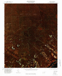
1980 Map of Topsail
USGS Topo · Published 1985About this map
Holly Shelter Swamp dominates the northern reaches of this coastal Pender County landscape, its dense wetland terrain punctuated by the winding paths of Catskin Creek and Trumpeter Swamp. The infrared orthophoto imagery reveals the stark contrast between the undisturbed pocosin habitats and the encroaching development near the coast. Along the southeastern edge, the map documents the community of Topsail and the nearby settlement of Woodside, where residential grids and cleared lands begin to replace the natural drainage patterns of Harrisons Creek. The transition from the massive interior swamps to the tidal waters of Topsail Sound illustrates the unique ecological and developmental boundary of the North Carolina coast during the early 1980s.
Find a feature on this map
10 named features on this map. Tap any name to fly to it.
Don’t see what you’re looking for? This feature index may not catch every label — zoom into the map to look around manually.
Map Details
Editions of this 1980 Topsail Map
2 editions found

Other maps of this area

1942 · Topsail
USGS Topo · 1:62,500

1942 · Burgaw
USGS Topo · 1:62,500

1947 · Rocky Point
USGS Topo · 1:62,500

1948 · Maple Hill
USGS Topo · 1:62,500

1948 · Topsail
USGS Topo · 1:62,500

1953 · Beaufort
USGS Topo · 1:250,000

1954 · Beaufort
USGS Topo · 1:250,000

1970 · Hampstead
USGS Topo · 1:24,000

1970 · Topsail
USGS Topo · 1:24,000

1970 · Scotts Hill
USGS Topo · 1:24,000