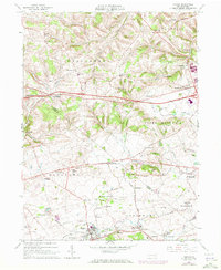
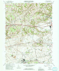
1965 Map of Topton
USGS Topo · Published 1972About this map
Topton and Mertztown anchor the southern corridor of this Pennsylvania landscape, where the Reading railroad line tracks through the valley of Toad Creek. The 1960s and 70s terrain reveals a traditional agricultural and industrial layout, with numerous small crossroads settlements like Seipstown, Claussville, and Maxatawny serving the surrounding farms. The influence of early German settlement is evident in the presence of Ziegel Church and St Pauls Ch, alongside rural schoolhouses like Weisenberg Sch.
Find a feature on this map
73 named features on this map. Tap any name to fly to it.
Don’t see what you’re looking for? This feature index may not catch every label — zoom into the map to look around manually.
Map Details
Editions of this 1965 Topton Map
5 editions found
Other maps of this area

1894 · Reading
USGS Topo · 1:62,500

1902 · Boyertown
USGS Topo · 1:62,500

1902 · Slatington
USGS Topo · 1:62,500

1909 · Hamburg
USGS Topo · 1:62,500

1911 · Hamburg
USGS Topo · 1:62,500

1913 · Reading
USGS Topo · 1:62,500

1915 · Reading
USGS Topo · 1:62,500

1937 · Allentown West
USGS Topo · 1:48,000

1942 · Allentown West
USGS Topo · 1:62,500

1943 · Manatawny
USGS Topo · 1:31,680