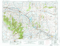
1954 Map of Torrington
USGS Topo · Published 1976About this map
Fort Laramie National Historic Site stands as a central landmark along the North Platte River, marking a geography defined by the transition from the high plains to the mountain front. This mid-century survey illustrates a landscape of established ranching and vital water management, where the Glendo Reservoir and Guernsey Reservoir provide critical infrastructure for the arid eastern Wyoming region. The convergence of major transportation corridors is evident, as the Burlington Northern and Chicago and North Western railroads follow the river valleys, connecting eastern agricultural hubs like Torrington and Lusk with the industrial centers of Douglas and Glenrock. To the west, the rising elevations of the Medicine Bow National Forest and Laramie Peak dominate the skyline, while historic migration markers like Register Cliff remain preserved on the landscape.
Find a feature on this map
108 named features on this map. Tap any name to fly to it.
Don’t see what you’re looking for? This feature index may not catch every label — zoom into the map to look around manually.
Map Details
Editions of this 1954 Torrington Map
4 editions found

Other maps of this area

1896 · Patrick
USGS Topo · 1:125,000

1896 · Hartville
USGS Topo · 1:125,000

1898 · Scotts Bluff
USGS Topo · 1:125,000

1899 · Goshen Hole
USGS Topo · 1:125,000

1899 · Whistle Creek
USGS Topo · 1:125,000

1901 · Hartville
USGS Topo · 1:125,000

1902 · Edgemont
USGS Topo · 1:125,000

1915 · Como Ridge
USGS Topo · 1:48,000

1918 · Como Ridge
USGS Topo · 1:62,500

1943 · Esterbrook
USGS Topo · 1:62,500