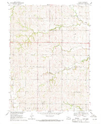
1969 Map of Touhy
USGS Topo · Published 1971About this map
The settlement of Touhy anchors this agricultural landscape in Saunders County, situated at the junction of the Union Pacific railroad and localized drainage basins. This late-1960s survey illustrates a rural social structure defined by its townships, including Elk, Mariposa, Newman, and Chapman, each dotted with the cornerstones of early Nebraska prairie life. Genealogy researchers will find significant value in the mapped locations of St Vitus Cem, National Cem, and Bethel Cem, which served the scattered farmstead families of the era.
Find a feature on this map
21 named features on this map. Tap any name to fly to it.
Don’t see what you’re looking for? This feature index may not catch every label — zoom into the map to look around manually.
Map Details
Editions of this 1969 Touhy Map
This is the sole edition of this map. No revisions or reprints were ever made.
Other maps of this area

1899 · Wahoo
USGS Topo · 1:125,000

1955 · Fremont
USGS Topo · 1:250,000

1957 · Fremont
USGS Topo · 1:250,000

1958 · Fremont
USGS Topo · 1:250,000

1968 · Bruno
USGS Topo · 1:24,000
1969 · Malmo
USGS Topo · 1:24,000
1969 · Valparaiso SW
USGS Topo · 1:24,000
1969 · Valparaiso
USGS Topo · 1:24,000
1969 · Loma
USGS Topo · 1:24,000
1969 · Prague
USGS Topo · 1:24,000