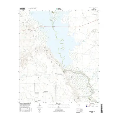
2016 Map of Town Bluff
USGS Topo · Published 2016About this map
B A Steinhagen Lake dominates the central landscape of this East Texas terrain, marking the boundary where the Neches River flows toward the Big Thicket National Preserve. The settlement of Town Bluff sits near the dam, overlooking a complex system of sloughs and oxbow lakes including McMickin Lake, Brushy Lake, and Barlow Lake. To the west, the topography rises toward Pedigo Hill, a localized height of land surrounded by several early burial grounds including Pedigo Cem, Supps Cem, and Moffet Cem. These features, along with the meandering course of Little Beech Cr and Rush Creek, reflect a landscape defined by its riverine geography and dense bottomland forests. The road network, including FM 92 and FM 1746, connects these established communities and family landmarks across the Tyler and Jasper county line.
Find a feature on this map
74 named features on this map. Tap any name to fly to it.
Don’t see what you’re looking for? This feature index may not catch every label — zoom into the map to look around manually.
Map Details
Editions of this 2016 Town Bluff Map
This is the sole edition of this map. No revisions or reprints were ever made.
Other maps of this area

1954 · Beaumont
USGS Topo · 1:250,000

1955 · Woodville
USGS Topo · 1:62,500

1955 · Curtis
USGS Topo · 1:62,500

1957 · Beaumont
USGS Topo · 1:250,000

1958 · Warren
USGS Topo · 1:62,500

1958 · Spurger
USGS Topo · 1:62,500

1984 · Beaumont
USGS Topo · 1:250,000
1984 · Boggy Lake
USGS Topo · 1:24,000
1984 · Beech Grove
USGS Topo · 1:24,000
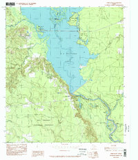
1984 · Town Bluff
USGS Topo · 1:24,000