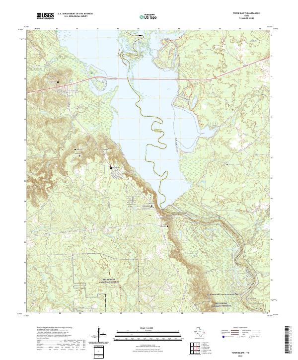
2022 Map of Town Bluff
USGS Topo · Published 2022About this map
The Neches River dominates this landscape, serving as the boundary between Tyler and Jasper Counties as it flows toward Cowart Bend. The area is defined by its complex hydrography, featuring numerous oxbow-style lakes and branches such as McMickin Lake, Brushy Lake, and Barlow Lake tucked within the bottomlands. To the south, the Big Thicket National Preserve protects a significant portion of this riverine environment, with the Beech Woods Trl providing access into the dense woodlands.
Find a feature on this map
84 named features on this map. Tap any name to fly to it.
Don’t see what you’re looking for? This feature index may not catch every label — zoom into the map to look around manually.
Map Details
Editions of this 2022 Town Bluff Map
This is the sole edition of this map. No revisions or reprints were ever made.
Other maps of this area

1954 · Beaumont
USGS Topo · 1:250,000

1955 · Woodville
USGS Topo · 1:62,500

1955 · Curtis
USGS Topo · 1:62,500

1957 · Beaumont
USGS Topo · 1:250,000

1958 · Warren
USGS Topo · 1:62,500

1958 · Spurger
USGS Topo · 1:62,500

1984 · Beaumont
USGS Topo · 1:250,000
1984 · Boggy Lake
USGS Topo · 1:24,000
1984 · Beech Grove
USGS Topo · 1:24,000
1984 · Town Bluff
USGS Topo · 1:24,000