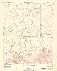
1950 Map of Town Creek
USGS Topo · Published 1950About this map
Town Creek serves as a central hub in this survey of the northern Alabama landscape, situated where the Southern Railway meets the Joe Wheeler Highway. The area is characterized by a dense network of small family-named ponds and community landmarks, such as Winston Quarters and the Winston Pond. Settlement patterns follow the topography, with Cottontown and Bingham established near the winding path of Town Creek. To the south, the terrain rises toward Patrick Mountain and Black Ground Mountain, where the Old Mi Zion Church and Baine Cem sit near the Colbert Co Lawrence Co line. This map records a mid-century rural economy tied to the land and rail, evidenced by the numerous small schools like St James Sch and Macedonia Sch that once served these dispersed communities.
Find a feature on this map
62 named features on this map. Tap any name to fly to it.
Don’t see what you’re looking for? This feature index may not catch every label — zoom into the map to look around manually.
Map Details
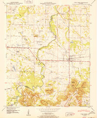
Editions of this 1950 Town Creek Map
2 editions found
Other maps of this area

1914 · Rogersville
USGS Topo · 1:48,000

1914 · Muscle Shoals
USGS Topo · 1:48,000

1916 · Muscle Shoals
USGS Topo · 1:62,500

1916 · Rogersville
USGS Topo · 1:62,500

1924 · Tuscumbia
USGS Topo · 1:48,000

1926 · Tuscumbia
USGS Topo · 1:62,500

1936 · Thorntontown
USGS Topo · 1:24,000

1936 · Courtland
USGS Topo · 1:24,000

1936 · Wheeler Dam
USGS Topo · 1:24,000

1936 · Town Creek
USGS Topo · 1:24,000