
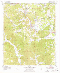
1949 Map of Townley
USGS Topo · Published 1969About this map
Townley serves as the central hub of this Walker County landscape, situated at the junction of the St Louis San Francisco RR and the Bankhead Highway. The area's industrial character is defined by the early extraction economy, evidenced by a Strip Mine north of town and various hills like Cedrum Mtn and Horse Mountain that dominate the topography. The settlement pattern is largely rural and dispersed, anchored by community landmarks such as Union Hill Church, Beech Grove Church, and the Palmer Sch.
Find a feature on this map
60 named features on this map. Tap any name to fly to it.
Don’t see what you’re looking for? This feature index may not catch every label — zoom into the map to look around manually.
Map Details
Editions of this 1949 Townley Map
3 editions found
Other maps of this area

1893 · Jasper
USGS Topo · 1:125,000

1949 · Parrish
USGS Topo · 1:24,000

1949 · Jasper
USGS Topo · 1:24,000

1949 · Oakman
USGS Topo · 1:24,000

1949 · Manchester
USGS Topo · 1:24,000

1949 · Nauvoo
USGS Topo · 1:24,000

1950 · Nauvoo
USGS Topo · 1:24,000

1950 · Manchester
USGS Topo · 1:24,000

1951 · Jasper
USGS Topo · 1:24,000
1951 · Parrish
USGS Topo · 1:24,000