
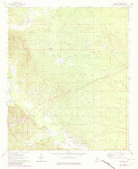
1963 Map of Townsend
USGS Topo · Published 1964About this map
Sucarnoochee Creek and its many tributaries, including Hamilton Branch and Snoody Creek, dominate this Kemper County landscape. The settlement of Townsend sits in the southern portion of the map, connected to the surrounding countryside by a network of unimproved roads and an Old Railroad Grade that cuts diagonally across the center of the sheet. This terrain is marked by significant local history sites for genealogists, including Antioch Ch and Stonewall Ch, as well as Felton Cem and Cherry Cem. The water system is particularly dense here, featuring Big Scooba Creek, Hoppers Lake, and Wahalak Creek in the north. The presence of the former rail line alongside these smaller family-named landmarks suggests an era of transition from rural rail-based commerce to modern land use.
Find a feature on this map
15 named features on this map. Tap any name to fly to it.
Don’t see what you’re looking for? This feature index may not catch every label — zoom into the map to look around manually.
Map Details
Editions of this 1963 Townsend Map
2 editions found
Other maps of this area

1953 · Meridian
USGS Topo · 1:250,000

1957 · Meridian
USGS Topo · 1:250,000

1962 · Lauderdale NW
USGS Topo · 1:24,000

1962 · Oak Grove
USGS Topo · 1:24,000

1962 · Shuqualak
USGS Topo · 1:24,000

1963 · De Kalb
USGS Topo · 1:24,000

1963 · Gholson
USGS Topo · 1:24,000

1965 · Meridian
USGS Topo · 1:250,000

1973 · Scooba
USGS Topo · 1:24,000
1973 · Paulette
USGS Topo · 1:24,000