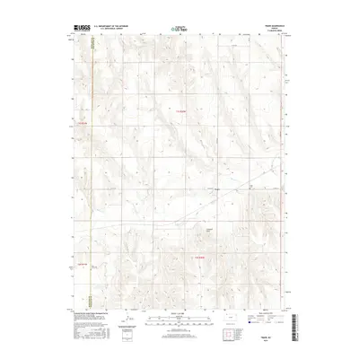
2015 Map of Traer
USGS Topo · Published 2015About this map
Traer serves as the focal point of this Northwest Kansas landscape, situated near the winding course of Beaver Cr. The terrain is defined by the gradual elevation changes of the high plains, punctuated by distinctive landmarks such as Elephant Rock. Rural life and heritage are anchored by local sites including Traer Cem and Saint Johns Cem, which are essential for those tracing family history in this portion of Decatur County. The map clearly delineates the border between Rawlins Co and Decatur Co, following the section lines of the Public Land Survey System. A network of county roads, such as Co RD 314 and Co RD 465, connects the scattered farmsteads and agricultural plots that dominate the township range.
Find a feature on this map
13 named features on this map. Tap any name to fly to it.
Don’t see what you’re looking for? This feature index may not catch every label — zoom into the map to look around manually.
Map Details
Editions of this 2015 Traer Map
This is the sole edition of this map. No revisions or reprints were ever made.
Other maps of this area

1951 · Herndon
USGS Topo · 1:62,500

1951 · Oberlin
USGS Topo · 1:62,500

1954 · McCook
USGS Topo · 1:250,000

1954 · Goodland
USGS Topo · 1:250,000

1956 · Goodland
USGS Topo · 1:250,000

1957 · McCook
USGS Topo · 1:250,000

1957 · Goodland
USGS Topo · 1:250,000

1957 · McCook SW
USGS Topo · 1:24,000

1957 · McCook SE
USGS Topo · 1:24,000

1958 · McCook
USGS Topo · 1:250,000