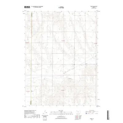
2018 Map of Traer
USGS Topo · Published 2018About this map
Traer serves as the central focal point of this Decatur County landscape, situated along the winding course of Beaver Cr. The terrain is defined by the sharp incisions of local creek drainage, where the elevated Elephant Rock stands out as a prominent landmark amidst the section-line grid of the High Plains. This 2018 survey documents the persistent rural infrastructure of the region, including the Rawlins Co Decatur Co boundary line and the essential road network of Co RD 314 and Co RD 465. For those researching local heritage, the map identifies specific points of historical continuity such as the Traer Cem east of the settlement and the Saint Johns Cem located further west near the county line, providing precise locations for family history research in this agricultural corridor.
Find a feature on this map
14 named features on this map. Tap any name to fly to it.
Don’t see what you’re looking for? This feature index may not catch every label — zoom into the map to look around manually.
Map Details
Editions of this 2018 Traer Map
This is the sole edition of this map. No revisions or reprints were ever made.
Other maps of this area

1951 · Herndon
USGS Topo · 1:62,500

1951 · Oberlin
USGS Topo · 1:62,500

1954 · McCook
USGS Topo · 1:250,000

1954 · Goodland
USGS Topo · 1:250,000

1956 · Goodland
USGS Topo · 1:250,000

1957 · McCook
USGS Topo · 1:250,000

1957 · Goodland
USGS Topo · 1:250,000

1957 · McCook SW
USGS Topo · 1:24,000

1957 · McCook SE
USGS Topo · 1:24,000

1958 · McCook
USGS Topo · 1:250,000