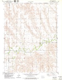
1978 Map of Traer
USGS Topo · Published 1979About this map
Traer serves as the focal point of this late 1970s survey, situated where the Burlington Northern railroad tracks follow the valley of Beaver Creek. The landscape is organized by the traditional township divisions of Finley, Richland, Beaver, Liberty, and Herndon, reflecting the deep-rooted agricultural and civic structure of northern Kansas near the Nebraska border. For genealogists and local historians, the map identifies specific landmarks such as Traer Cem and St Johns Cem, alongside evidence of industrial activity including a Quarry and scattered Oil Wells. The presence of a significant Pipeline and several named Wells underscores the regional reliance on subsurface resources for both energy and agriculture during this period.
Find a feature on this map
19 named features on this map. Tap any name to fly to it.
Don’t see what you’re looking for? This feature index may not catch every label — zoom into the map to look around manually.
Map Details
Editions of this 1978 Traer Map
This is the sole edition of this map. No revisions or reprints were ever made.
Other maps of this area

1951 · Herndon
USGS Topo · 1:62,500

1951 · Oberlin
USGS Topo · 1:62,500

1954 · McCook
USGS Topo · 1:250,000

1954 · Goodland
USGS Topo · 1:250,000

1956 · Goodland
USGS Topo · 1:250,000

1957 · McCook
USGS Topo · 1:250,000

1957 · Goodland
USGS Topo · 1:250,000

1957 · McCook SW
USGS Topo · 1:24,000

1957 · McCook SE
USGS Topo · 1:24,000

1958 · McCook
USGS Topo · 1:250,000