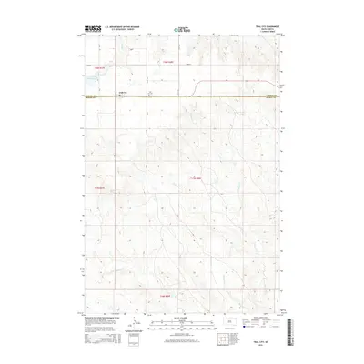
2015 Map of Trail City
USGS Topo · Published 2015About this map
Trail City sits at the intersection of local history and northern plains topography, straddling the boundary between Corson Co and Dewey Co. This 2015 snapshot illustrates a landscape defined by its drainages, including Snake Cr to the north and the winding paths of Du Charme Cr, Handboy Cr, and Marshall Cr further south. The presence of Trail City Railroad Lake and the Trail City Cem provides clear anchor points for genealogical research and local history studies in this part of South Dakota. A network of rural routes such as CR-7, 270th Ave, and 133rd St connects the scattered homesteads and pastures, revealing the persistent grid-based development that has shaped the region's agricultural character for decades.
Find a feature on this map
22 named features on this map. Tap any name to fly to it.
Don’t see what you’re looking for? This feature index may not catch every label — zoom into the map to look around manually.
Map Details
Editions of this 2015 Trail City Map
This is the sole edition of this map. No revisions or reprints were ever made.
Other maps of this area

1951 · Promise
USGS Topo · 1:24,000

1952 · Trail City SW
USGS Topo · 1:24,000

1952 · Glencross SE
USGS Topo · 1:24,000

1953 · McIntosh
USGS Topo · 1:250,000

1956 · Wakpala SE
USGS Topo · 1:24,000

1956 · Little Eagle SE
USGS Topo · 1:24,000

1956 · Wakpala SW
USGS Topo · 1:24,000

1958 · McIntosh
USGS Topo · 1:250,000

1975 · Laundreaux Butte
USGS Topo · 1:24,000

1975 · Trail City
USGS Topo · 1:24,000