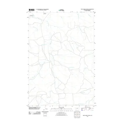
2011 Map of Trail Creek School
USGS Topo · Published 2011About this map
West Fork Armells Creek and its many tributaries carve through this section of Rosebud County, forming a complex drainage network typical of the eastern Montana plains. The map details a landscape managed for water and livestock, featuring the Ashenhurst Number 2 Dam and Wildhorse Pasture Dam at the northern edge. A series of numbered springs, such as 02N40E18DABD01Spring and 02N40E28CCBB01 Spring, point to the critical role of groundwater in this semi-arid region. Connectivity is maintained by local routes like Trail CR RD, Armells CR RD, and Stocker Creek RD, which follow the natural contours of the creeks. This survey provides a clear view of the rural ranching infrastructure and hydrological features that sustain the area.
Find a feature on this map
19 named features on this map. Tap any name to fly to it.
Don’t see what you’re looking for? This feature index may not catch every label — zoom into the map to look around manually.
Map Details
Editions of this 2011 Trail Creek School Map
This is the sole edition of this map. No revisions or reprints were ever made.
Other maps of this area

1954 · Hardin
USGS Topo · 1:250,000

1954 · Forsyth
USGS Topo · 1:250,000

1957 · Hardin
USGS Topo · 1:250,000

1957 · Forsyth
USGS Topo · 1:250,000

1958 · Forsyth
USGS Topo · 1:250,000

1958 · Hardin
USGS Topo · 1:250,000

1971 · Trail Creek School
USGS Topo · 1:24,000

1971 · Colstrip SW
USGS Topo · 1:24,000

1971 · Mc Clure Creek
USGS Topo · 1:24,000

1971 · Griffin Coulee SW
USGS Topo · 1:24,000