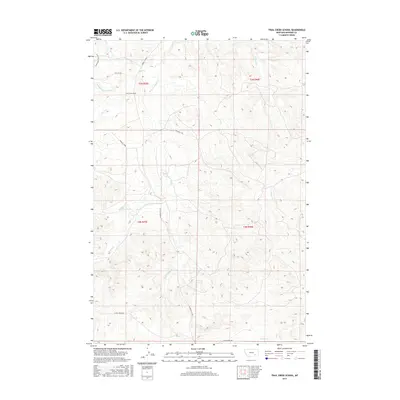
2017 Map of Trail Creek School
USGS Topo · Published 2017About this map
Trail Creek School stands as a focal point in this 2017 study of Rosebud County, Montana, where the headwaters of several drainage systems carve through the landscape. This rural area is defined by its network of watercourses, including the Middle Fork Trail Cr and N Fork Trail Cr, which converge near established ranching roads. The map reveals how local infrastructure follows these natural corridors, with Trail Cr Rd and Northfork Trail Cr Rd providing access to the more isolated upland regions.
Find a feature on this map
23 named features on this map. Tap any name to fly to it.
Don’t see what you’re looking for? This feature index may not catch every label — zoom into the map to look around manually.
Map Details
Editions of this 2017 Trail Creek School Map
This is the sole edition of this map. No revisions or reprints were ever made.
Other maps of this area

1954 · Hardin
USGS Topo · 1:250,000

1954 · Forsyth
USGS Topo · 1:250,000

1957 · Hardin
USGS Topo · 1:250,000

1957 · Forsyth
USGS Topo · 1:250,000

1958 · Forsyth
USGS Topo · 1:250,000

1958 · Hardin
USGS Topo · 1:250,000

1971 · Trail Creek School
USGS Topo · 1:24,000

1971 · Colstrip SW
USGS Topo · 1:24,000

1971 · Mc Clure Creek
USGS Topo · 1:24,000

1971 · Griffin Coulee SW
USGS Topo · 1:24,000