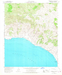
1959 Map of Tranquillon Mountain
USGS Topo · Published 1968About this map
The U S Naval Missile Facility dominates the northern reaches of this coastal landscape, situated among the steep canyons and ridges of the Santa Ynez Mountains. Along the shore, the Southern Pacific railroad follows the narrow shelf of the Pacific Flats and the curving coastline, connecting small coastal points like Sudden and The Espada. The terrain is defined by deep drainage systems such as Cañada Agua Viva and Cañada del Rodeo, which flow toward the Pacific Ocean from high points like Tranquillon Mtn.
Find a feature on this map
49 named features on this map. Tap any name to fly to it.
Don’t see what you’re looking for? This feature index may not catch every label — zoom into the map to look around manually.
Map Details
Editions of this 1959 Tranquillon Mountain Map
3 editions found
Other maps of this area

1905 · Guadalupe
USGS Topo · 1:125,000

1905 · Lompoc
USGS Topo · 1:125,000

1942 · Point Arguello
USGS Topo · 1:62,500

1942 · Guadalupe
USGS Topo · 1:125,000

1942 · Lompoc
USGS Topo · 1:125,000

1942 · Lompoc
USGS Topo · 1:62,500

1942 · Pt. Conception
USGS Topo · 1:62,500

1943 · Lompoc
USGS Topo · 1:125,000

1947 · Lompoc
USGS Topo · 1:24,000

1947 · Surf
USGS Topo · 1:24,000