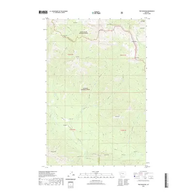
2020 Map of Trap Mountain
USGS Topo · Published 2020About this map
Lewis and Clark Range dominates the high-altitude landscape of this 2020 survey, marking the continental divide's complex topography. The boundary between Lewis and Clark National Forest and Flathead National Forest bisects the area, where water flows from high peaks into the Danaher Cr and Rapid Creek drainages. A notable high point, Twin Peaks, stands near the northern edge, while the southern reaches are defined by the massifs of Sentinel Mtn and Woodtick Mtn. The hydrology is particularly intricate here, with numerous forks and spurs such as Basin Creek Spur and E Side S Fork carving through deep basins like Pearl Basin and Grizzly Basin. Camp Creek Pass serves as a critical geographic transition point in the northwest, providing a rare traversable break in the steep elevations of Trap Mtn and Hoadley Reef.
Find a feature on this map
41 named features on this map. Tap any name to fly to it.
Don’t see what you’re looking for? This feature index may not catch every label — zoom into the map to look around manually.
Map Details
Editions of this 2020 Trap Mountain Map
This is the sole edition of this map. No revisions or reprints were ever made.
Other maps of this area

1902 · Ovando
USGS Topo · 1:125,000

1903 · Saypo
USGS Topo · 1:125,000

1903 · Coopers Lake
USGS Topo · 1:125,000

1905 · Ovando
USGS Topo · 1:125,000

1936 · Silvertip
USGS Topo · 1:96,000

1942 · Silvertip
USGS Topo · 1:125,000

1955 · Choteau
USGS Topo · 1:250,000

1957 · Choteau
USGS Topo · 1:250,000

1958 · Choteau
USGS Topo · 1:250,000

1958 · Pretty Prairie
USGS Topo · 1:24,000