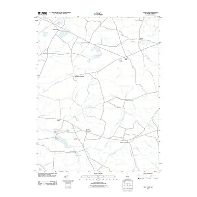
2011 Map of Trap Pond
USGS Topo · Published 2011About this map
Saint Thomas Cemetery stands near the center of this rural Sussex County landscape, serving as a landmark for the surrounding communities in the early 21st century. The map reveals a distinct pattern of crossroads settlements, including Bryans Store, Whaleys Crossroads, and Hitchens Crossroads, which define the local geography. Water management is a central theme, evidenced by an extensive network of ditches and branches feeding into the Pocomoke River and Bald Cypress Branch.
Find a feature on this map
74 named features on this map. Tap any name to fly to it.
Don’t see what you’re looking for? This feature index may not catch every label — zoom into the map to look around manually.
Map Details
Editions of this 2011 Trap Pond Map
This is the sole edition of this map. No revisions or reprints were ever made.
Other maps of this area

1901 · Salisbury
USGS Topo · 1:62,500

1902 · Pittsville
USGS Topo · 1:62,500

1915 · Seaford
USGS Topo · 1:62,500

1917 · Millsboro
USGS Topo · 1:62,500

1938 · Millsboro
USGS Topo · 1:62,500

1942 · Whaleysville
USGS Topo · 1:24,000

1942 · Delmar
USGS Topo · 1:24,000

1942 · Pittsville
USGS Topo · 1:24,000
1943 · Delmar
USGS Topo · 1:31,680
1943 · Whaleysville
USGS Topo · 1:31,680