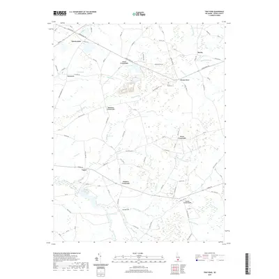
2019 Map of Trap Pond
USGS Topo · Published 2019About this map
Hardscrabble and the surrounding rural landscape of Sussex County are defined by a dense network of historic intersections and watercourses. This area, dominated by farming and timber history, is marked by numerous crossroads settlements such as Jones Crossroads, Hitchens Crossroads, and Pusey Crossroads, which served as local gathering points for the surrounding agricultural community. The land is intricately drained by a complex system of ditches and branches, including Sheep Pen Ditch and Dukes Ditch, flowing toward the Pocomoke River.
Find a feature on this map
99 named features on this map. Tap any name to fly to it.
Don’t see what you’re looking for? This feature index may not catch every label — zoom into the map to look around manually.
Map Details
Editions of this 2019 Trap Pond Map
This is the sole edition of this map. No revisions or reprints were ever made.
Other maps of this area

1901 · Salisbury
USGS Topo · 1:62,500

1902 · Pittsville
USGS Topo · 1:62,500

1915 · Seaford
USGS Topo · 1:62,500

1917 · Millsboro
USGS Topo · 1:62,500

1938 · Millsboro
USGS Topo · 1:62,500

1942 · Whaleysville
USGS Topo · 1:24,000

1942 · Delmar
USGS Topo · 1:24,000

1942 · Pittsville
USGS Topo · 1:24,000
1943 · Delmar
USGS Topo · 1:31,680
1943 · Whaleysville
USGS Topo · 1:31,680