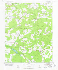
1954 Map of Trap Pond
USGS Topo · Published 1955About this map
Trap Pond and the surrounding Delaware State Park serve as the central landmarks of this Sussex County landscape. The terrain is defined by an intricate network of drainage and natural waterways, including the Pocomoke River, Pepper Br, and Dukes Ditch, which underscore the low-lying nature of the region. This mid-century survey captures a rural community organized around traditional intersections and small local institutions. Numerous crossroads settlements such as Hardscrabble, Whaleys Crossroads, and Jones Crossroads anchor the agricultural districts, while local life is further evidenced by landmarks like the Ross Point Sch and several country churches including Mt Olivet Ch and St Thomas Ch. The map illustrates a period before significant suburbanization, where the rural road network followed the contours of streams and branches like Asketum Branch and Saunders Branch.
Find a feature on this map
47 named features on this map. Tap any name to fly to it.
Don’t see what you’re looking for? This feature index may not catch every label — zoom into the map to look around manually.
Map Details
Editions of this 1954 Trap Pond Map
2 editions found
Other maps of this area

1901 · Salisbury
USGS Topo · 1:62,500

1902 · Pittsville
USGS Topo · 1:62,500

1915 · Seaford
USGS Topo · 1:62,500

1917 · Millsboro
USGS Topo · 1:62,500

1938 · Millsboro
USGS Topo · 1:62,500

1942 · Whaleysville
USGS Topo · 1:24,000

1942 · Delmar
USGS Topo · 1:24,000

1942 · Pittsville
USGS Topo · 1:24,000
1943 · Delmar
USGS Topo · 1:31,680
1943 · Whaleysville
USGS Topo · 1:31,680