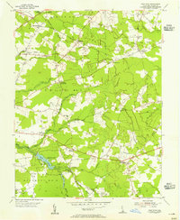
1955 Map of Trap Pond
USGS Topo · Published 1955About this map
The Trap Pond State Park corridor in Sussex County defines this mid-century landscape, centered on the waters of Trap Pond and its surrounding wetlands. The geography is characterized by an intricate network of drainage ditches and branches, including Jabs Ditch, Dukes Ditch, and the Savannah Ditch, illustrating the persistent efforts to manage the low-lying terrain for agricultural use. Small, rural settlements are clustered at nearly every major intersection, from Hardscrabble in the northwest to Lowes Crossroads in the southeast.
Find a feature on this map
44 named features on this map. Tap any name to fly to it.
Don’t see what you’re looking for? This feature index may not catch every label — zoom into the map to look around manually.
Map Details
Editions of this 1955 Trap Pond Map
This is the sole edition of this map. No revisions or reprints were ever made.
Other maps of this area

1901 · Salisbury
USGS Topo · 1:62,500

1902 · Pittsville
USGS Topo · 1:62,500

1915 · Seaford
USGS Topo · 1:62,500

1917 · Millsboro
USGS Topo · 1:62,500

1938 · Millsboro
USGS Topo · 1:62,500

1942 · Whaleysville
USGS Topo · 1:24,000

1942 · Delmar
USGS Topo · 1:24,000

1942 · Pittsville
USGS Topo · 1:24,000
1943 · Delmar
USGS Topo · 1:31,680
1943 · Whaleysville
USGS Topo · 1:31,680