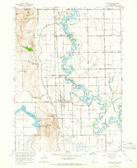
1964 Map of Trenton
USGS Topo · Published 1966About this map
The meandering Bear River dominates this mid-1960s survey of the Cache Valley, where its serpentine path cuts through the heart of northern Utah and southern Idaho. To the south, water management is anchored by the Newton Reservoir and the precise engineering of the Newton Dam Spillway Elev 4769. This landscape is a patchwork of small agricultural centers and rail infrastructure, defined by the Union Pacific line and its Cache Valley Branch which connect the communities of Trenton, Cornish, and Amalga.
Find a feature on this map
46 named features on this map. Tap any name to fly to it.
Don’t see what you’re looking for? This feature index may not catch every label — zoom into the map to look around manually.
Map Details
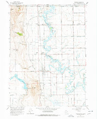
Editions of this 1964 Trenton Map
2 editions found
Other maps of this area

1914 · Logan
USGS Topo · 1:125,000

1915 · Preston
USGS Topo · 1:96,000

1916 · Logan
USGS Topo · 1:125,000

1918 · Preston
USGS Topo · 1:125,000

1954 · Pocatello
USGS Topo · 1:250,000

1954 · Ogden
USGS Topo · 1:250,000

1954 · Brigham City
USGS Topo · 1:250,000

1955 · Preston
USGS Topo · 1:250,000

1958 · Ogden
USGS Topo · 1:250,000

1958 · Pocatello
USGS Topo · 1:250,000