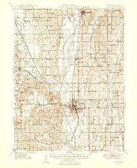
1948 Map of Trenton
USGS Topo · Published 1948About this map
The Thompson River and Weldon River converge near Trenton, shaping the development of Grundy County during the mid-twentieth century. This survey documents a landscape defined by traditional rural community hubs, featuring an exceptional density of country schools such as McVay Sch, Knightstown Sch, and Baker Sch. The Chicago Rock Island and Pacific and Chicago Milwaukee St Paul and Pacific railroads intersect in the county seat, underscoring the town's importance as a regional transportation node.
Find a feature on this map
77 named features on this map. Tap any name to fly to it.
Don’t see what you’re looking for? This feature index may not catch every label — zoom into the map to look around manually.
Map Details
Editions of this 1948 Trenton Map
2 editions found

Other maps of this area

1921 · Chillicothe
USGS Topo · 1:62,500

1922 · Gallatin
USGS Topo · 1:62,500

1923 · Chillicothe
USGS Topo · 1:62,500

1924 · Chula
USGS Topo · 1:62,500

1925 · Gilman
USGS Topo · 1:62,500

1946 · Gilman
USGS Topo · 1:48,000

1946 · Princeton
USGS Topo · 1:62,500

1946 · Galt
USGS Topo · 1:62,500

1947 · Blythedale
USGS Topo · 1:62,500

1947 · Chula
USGS Topo · 1:62,500