
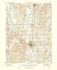
1948 Map of Trenton
USGS Topo · Published 1948About this map
Trenton serves as the focal point of this mid-century Grundy County landscape, where the Chicago Rock Island and Pacific railroad bisects the terrain. The map captures a well-developed rural infrastructure of the late 1940s, marked by an exceptionally dense network of country schools such as Big Oak Sch, Oak Ridge Sch, and South Evans Sch. The winding Thompson River and its Old Channel define the western geography, bordering the newly established Crowder State Park.
Find a feature on this map
81 named features on this map. Tap any name to fly to it.
Don’t see what you’re looking for? This feature index may not catch every label — zoom into the map to look around manually.
Map Details
Editions of this 1948 Trenton Map
2 editions found
Other maps of this area

1921 · Chillicothe
USGS Topo · 1:62,500

1922 · Gallatin
USGS Topo · 1:62,500

1923 · Chillicothe
USGS Topo · 1:62,500

1924 · Chula
USGS Topo · 1:62,500

1925 · Gilman
USGS Topo · 1:62,500

1946 · Gilman
USGS Topo · 1:48,000

1946 · Princeton
USGS Topo · 1:62,500

1946 · Galt
USGS Topo · 1:62,500

1947 · Blythedale
USGS Topo · 1:62,500

1947 · Chula
USGS Topo · 1:62,500