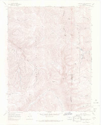
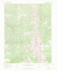
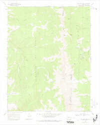
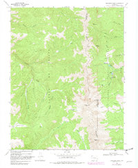
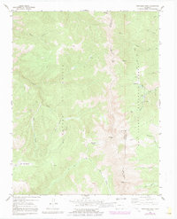
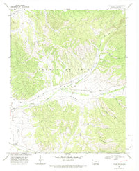
1967 Map of Trinchera Peak
USGS Topo · Published 1971About this map
The Sangre de Cristo Range dominates this 1967 survey, where high-altitude peaks and deep canyons converge at the borders of Costilla, Huerfano, and Las Animas counties. Rising over the terrain is Trinchera Peak, flanked by Teddys Peak and the expansive Beccerro Basin. The landscape is a study in watershed division and resource access, showing the headwaters of the North Fork Purgatoire River and Trinchera Creek flowing from the divide. Within the San Isabel National Forest, established recreational sites like Blue Lakes Campground and Bear Lake Campground indicate the area's mid-century role in public land use. For the mineral historian, the map identifies a specific Mine near the county line and various Prospects scattered near Hells Canyon, reflecting the legacy of prospecting in these high alpine basins.
Find a feature on this map
41 named features on this map. Tap any name to fly to it.
Don’t see what you’re looking for? This feature index may not catch every label — zoom into the map to look around manually.
Map Details
Editions of this 1967 Trinchera Peak Map
5 editions found
Other maps of this area

1954 · Trinidad
USGS Topo · 1:250,000

1955 · Trinidad
USGS Topo · 1:250,000

1958 · Trinidad
USGS Topo · 1:250,000

1959 · Trinidad
USGS Topo · 1:250,000
1963 · Mc Carty Park
USGS Topo · 1:24,000
1963 · Cuchara
USGS Topo · 1:24,000
1967 · Ojito Peak
USGS Topo · 1:24,000
1967 · Cucharas Pass
USGS Topo · 1:24,000
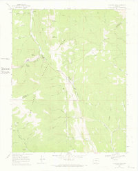
1967 · Trinchera Ranch
USGS Topo · 1:24,000
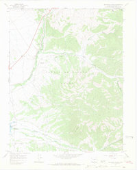
1967 · Taylor Ranch
USGS Topo · 1:24,000