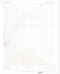
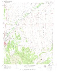
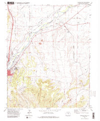
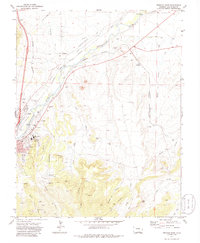
1971 Map of Trinidad East
USGS Topo · Published 1974About this map
The Purgatoire River valley serves as the primary corridor for settlement and transit east of the regional hub of Trinidad. This landscape is defined by the transition from river-fed agriculture to the industrial history of the surrounding canyons. A dense network of irrigation works, including the Picketwire Ditch, Chili Ditch, and Johns Canal, supports the valley floor, while the upland terrain to the south is marked by the coal mining heritage of the Engleville Mine and Highline Mine. The convergence of the Colorado and Southern and the Atchison Topeka and Santa Fe railroads near El Moro highlights the area's importance as a transportation junction. Cultural landmarks such as the Ave Maria Shrine and the Mt San Rafael Hospital reflect the established community in this corner of Las Animas County during the early 1970s.
Find a feature on this map
54 named features on this map. Tap any name to fly to it.
Don’t see what you’re looking for? This feature index may not catch every label — zoom into the map to look around manually.
Map Details
Editions of this 1971 Trinidad East Map
4 editions found
Other maps of this area

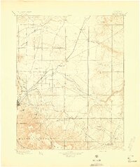
1891 · Spanish Peaks
USGS Topo · 1:125,000

1892 · Elmoro
USGS Topo · 1:125,000

1893 · Spanish Peaks
USGS Topo · 1:125,000

1893 · Elmoro
USGS Topo · 1:125,000

1895 · Spanish Peaks
USGS Topo · 1:125,000
1897 · Elmoro
USGS Topo · 1:125,000

1897 · Spanish Peaks
USGS Topo · 1:125,000

1900 · Spanish Peaks
USGS Topo · 1:125,000
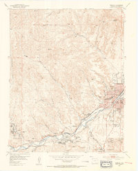
1951 · Trinidad
USGS Topo · 1:24,000
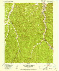
1951 · Starkville
USGS Topo · 1:24,000