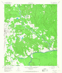
1960 Map of Trinity East
USGS Topo · Published 1968About this map
White Rock Creek meanders through the heart of the Piney Woods, carving a winding path toward the Trinity River along the southern boundary of the quadrangle. In this early 1960s landscape, the town of Trinity serves as a regional hub, where the Missouri Pacific railroad line intersects with the local infrastructure. The terrain is marked by the legacies of older industry and transport, evidenced by an Old Railroad Grade that cuts across the timberlands. East of the main settlement, the community of Sebastopol sits near the riverbanks, while smaller locales like Mill Town reflect the area's historical ties to the lumber and milling economy. Numerous water features, including Skaines Lake and Little Robbs Lake, dot the lowlands, and a Gravel Pit indicates the extraction of natural resources from the local geology.
Find a feature on this map
15 named features on this map. Tap any name to fly to it.
Don’t see what you’re looking for? This feature index may not catch every label — zoom into the map to look around manually.
Map Details
Editions of this 1960 Trinity East Map
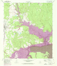
Other maps of this area

1953 · Palestine
USGS Topo · 1:250,000

1954 · Beaumont
USGS Topo · 1:250,000

1957 · Beaumont
USGS Topo · 1:250,000

1957 · Palestine
USGS Topo · 1:250,000

1960 · Trinity West
USGS Topo · 1:24,000

1960 · Trinity East
USGS Topo · 1:24,000

1960 · Carlisle
USGS Topo · 1:24,000

1961 · Staley
USGS Topo · 1:24,000

1961 · Riverside
USGS Topo · 1:24,000

1962 · Lovelady South
USGS Topo · 1:24,000