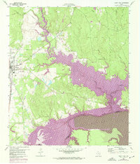
1960 Map of Trinity East
USGS Topo · Published 1974About this map
Trinity serves as the regional hub on the western edge of this survey, where the Missouri Pacific railroad cuts a north-south path through the timber and river bottoms. The landscape is defined by the significant hydrological changes occurring in the early 1970s, specifically the expansion of Lake Livingston along the Trinity River. Extensive areas of the river basin and its tributaries, including White Rock Creek and White Rock Caney Creek, are marked for controlled inundation, illustrating the transformation of East Texas bottomlands into a major reservoir system.
Find a feature on this map
14 named features on this map. Tap any name to fly to it.
Don’t see what you’re looking for? This feature index may not catch every label — zoom into the map to look around manually.
Map Details
Editions of this 1960 Trinity East Map
Other maps of this area

1953 · Palestine
USGS Topo · 1:250,000

1954 · Beaumont
USGS Topo · 1:250,000

1957 · Beaumont
USGS Topo · 1:250,000

1957 · Palestine
USGS Topo · 1:250,000

1960 · Trinity West
USGS Topo · 1:24,000

1960 · Trinity East
USGS Topo · 1:24,000

1960 · Carlisle
USGS Topo · 1:24,000

1961 · Staley
USGS Topo · 1:24,000

1961 · Riverside
USGS Topo · 1:24,000

1962 · Lovelady South
USGS Topo · 1:24,000