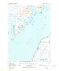
1952 Map of Trinity Islands D-1
USGS Topo · Published 1977About this map
The coastal settlement of Akhiok sits at the heart of this mid-century survey of southwestern Kodiak Island, overlooking the complex waters of Akhiok Bay and the nearby Akhiok Island. The landscape is defined by its deep maritime connections, featuring a Seaplane Base and a Cannery that anchored the local economy during this era. Navigation and resource extraction are central themes, with the map detailing the intricate shorelines of Alitak Lagoon and the narrow passages of Little Narrows.
Find a feature on this map
45 named features on this map. Tap any name to fly to it.
Don’t see what you’re looking for? This feature index may not catch every label — zoom into the map to look around manually.
Map Details
Editions of this 1952 Trinity Islands D-1 Map
3 editions found
Other maps of this area

1951 · Kaguyak
USGS Topo · 1:250,000

1951 · Trinity Islands
USGS Topo · 1:250,000

1951 · Karluk
USGS Topo · 1:250,000

1952 · Kodiak
USGS Topo · 1:250,000

1952 · Kaguyak
USGS Topo · 1:250,000

1952 · Karluk
USGS Topo · 1:250,000

1952 · Trinity Islands D-2
USGS Topo · 1:63,360

1952 · Trinity Islands D-1
USGS Topo · 1:63,360

1952 · Karluk A-1
USGS Topo · 1:63,360

1952 · Kaguyak D-6
USGS Topo · 1:63,360